Generative Design Computing

The idea is to be inspired by the Python Turtle library (not to copy it) and develop functions that work as a drawing toolkit. The premise of this part is to create a library with a deeper understanding of creating a python library, how to reuse code, implement functions and call them from another project/file.
Design Focus
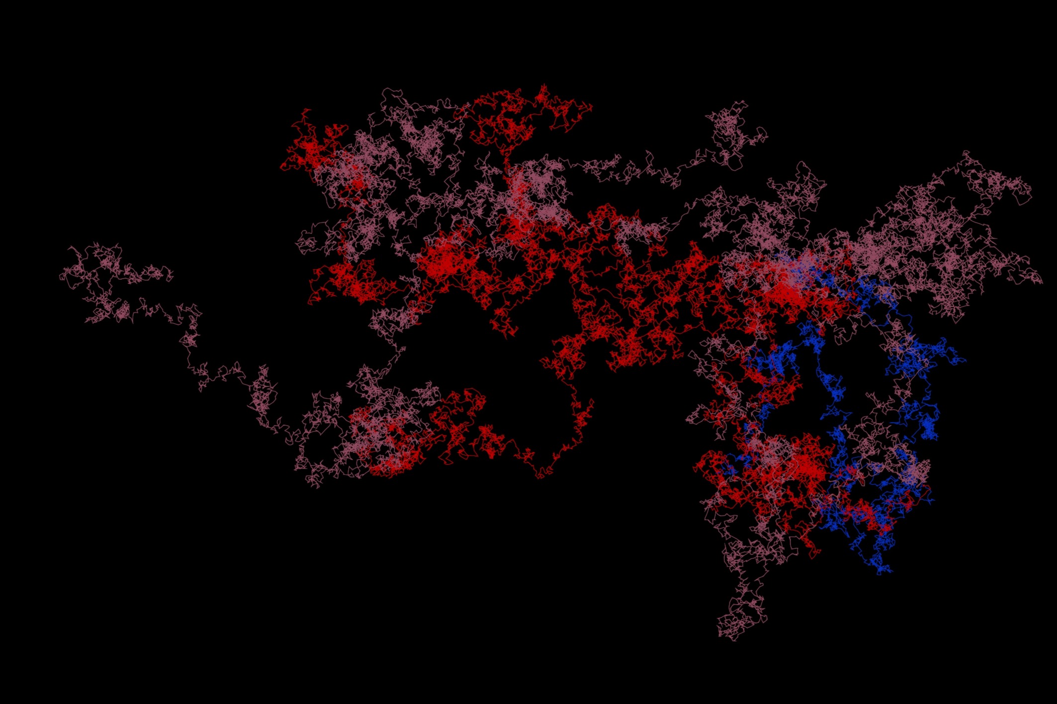
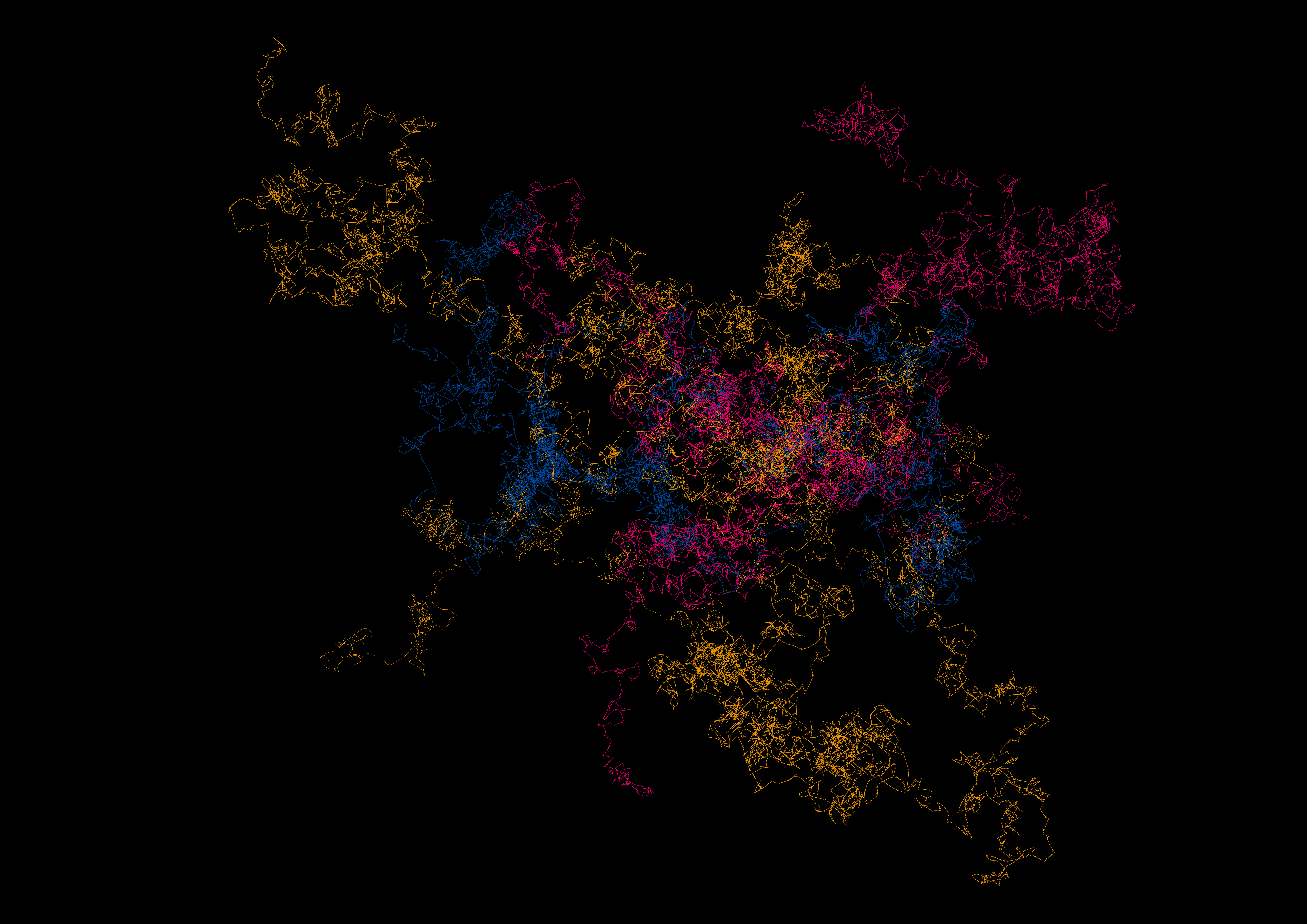
We produced three illustrations using a canvas of 100 x 100 units in Rhino. These illustrations should be similar, meaning that they should be based on a similar concept and then varies from each other by their set of rules and the implementation of those rules. Researching mathematical functions, fractal shapes, or social, economic, or biologic concepts that could be translated into code is highly recommended.
Drawings Produced Using Rhino Python Library Developed
1. A monumental interactive sculpture in the sky. Choreographed by visitors in real time through their mobile devices, the sculpture is a crowd-controlled visual artwork on a giant, floating canvas from Janet Echelman.
.jpg)
Data Visualization Using ghPython
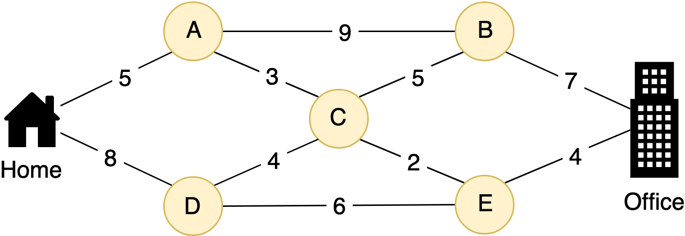
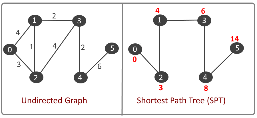
I have taken reference from “Dijkstra's algorithm” which provided the shortest path from a particular node to different other nodes, and my idea is to have an animation that shows/explains to people the possibility of going to different bike/light rail stations when they are present at a particular bike /light rail station. so that it would help them make an informed decision about their movement if they would like to go one bike station or the other or it would save their time to take light rail or bike. For example, if someone is at 9th street station would it be easier for him/her to take light rail for the next station or take bikes.
Design Logic
Visualization
Summary and Foundation for Future Research
This project allowed me to experiment with many datasets accessible in Charlotte and develop useful visuals from them. This study also allowed me to investigate the notion of the “djskakstra algorithm,” which is typically used to locate the shortest path to destination. I would like to apply this approach in the future to create more comparable visuals.